|

Spatial Technologies For All Resources - Custom GeoWeb Software Tools
- STAR is a secure, interactive, 3D GeoWeb-based decision-support system enhanced by custom technical tools and software development services.
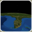
- STAR uses a secure virtual 3D globe platform to centrally access disparate databases.
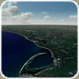
- STAR displays geospatialized data including high-resolution GIS raster image and vector files, documentation and other remotely served spatial information.
- STAR integrates software applications that provide customized and comprehensive data analysis.
- STAR program goals are to improve the speed and precision of resource and operational asset management for decision making.
- STAR technologies represent a paradigm shift in shared geospatial data presentation.

- Integrated secure GeoWeb hosting services with customizable software
- 3D virtual globe interface
- OGC compliance
- Secure login and authorization access
- Layer loading and selected layer viewing
- Custom tools that interact with databases for in-depth analyses
- Secure network connection and data transfer
- Ability to share information, maps, and layers with other STAR users
- Management and contractor interface for file uploading, progress tracking and analysis
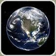
STAR is secure middle-tier software that works with several virtual globe interfaces. One of these is NASA's World Wind.
Click to download this free globe interface:

|
|